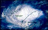
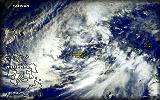
Click here to view Kiko's full NOAA/OSEI Enhanced Image! Tropical Storm KIKO (Nari/20W)
September 16 - 19
Max. Sustained Winds: 85 kph* (45 kts.)
Pressure: 990 mb.
[Storm Log|Tracks: PAGASA/JTWC|Summary|Cool Movie]


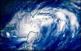
Click here to view Labuyo's full NOAA/OSEI Enhanced Image! Typhoon LABUYO (Lekima/23W)
September 22 - 28
Max. Sustained Winds: 175 kph (95 kts.)
Pressure: 960 mb.
[Storm Log|Tracks: PAGASA/JTWC|Summary|Cool Movie]


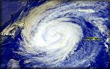
Click here to view Maring's full NOAA/OSEI Enhanced Image! Typhoon MARING (Haiyan/25W)
October 11 - 16
Max. Sustained Winds: 165 kph (90 kts.)
Pressure: 960 mb.
[Storm Log|Tracks: PAGASA/JTWC|Summary|Cool Movie]


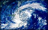
Click here to view Nanang's full NOAA-OSEI Enhanced Image! Typhoon NANANG (Lingling/27W) Deadly/Disastrous
November 06 - 10
Max. Sustained Winds: 215 kph (115 kts.)
Pressure: 940 mb.
[Storm Log|Tracks: PAGASA/JTWC|Summary|Cool Flash Movie]
[Flash Animations: Hitting Southern Philippines/Hitting Vietnam]
[Images: Over Visayas/Over South China Sea|Aftermath Reports]


Click here to view Ondoy's full NOAA-OSEI Enhanced Image! Tropical Storm ONDOY (28W)
November 20 - 25
Max. Sustained Winds: 75 kph* (40 kts.)
Pressure: 996 mb.
[Storm Log|Tracks: PAGASA/JTWC|Summary|Cool Movie]


Back | Page 1 2 [3] 4 Next... | Top

- Deadly/Disastrous

:: This summary is based on Tropical Cyclones within the Philippine Area of Responsibility (PAR) ::

[Note: Local names issued by PAGASA; In parenthesis are Int'l. names given by UN Typhoon Committee and
followed by JTWC's designated TC Number / Maximum Sustained Winds based on 1-Min. Average (JTWC)
except as indicated (*): based on 10-Min. Average (PAGASA) / Pressure by JMA / JTWC Tracks by Hawaii
Solar Institute / Storm's Summary courtesy of JTWC's 2001 ATCR / Thumbnail images courtesy of
NOAA-OSEI, NRL Monterey, & Central Weather Bureau of Taiwan]


This page was last updated:
Thur, Feb 21, 2002 @ 06:37 UTC