 |
||||||||||||||||||||||||||||||||||||||||||||||||||||||||||||||||||||||||||||||||||||||||||||||||||||||||||||||||||||||||||||||||||||||||||||||||||||||||||
|
Home | 2006 Season | Names | Weather Station | Observations | Archives | Info | Discussion | Links | SiteMap | Contact |
||||||||||||||||||||||||||||||||||||||||||||||||||||||||||||||||||||||||||||||||||||||||||||||||||||||||||||||||||||||||||||||||||||||||||||||||||||||||||
|
| ||||||||||||||||||||||||||||||||||||||||||||||||||||||||||||||||||||||||||||||||||||||||||||||||||||||||||||||||||||||||||||||||||||||||||||||||||||||||||

 THE 2007 PHILIPPINE TROPICAL CYCLONES SUMMARY THE 2007 PHILIPPINE TROPICAL CYCLONES SUMMARY
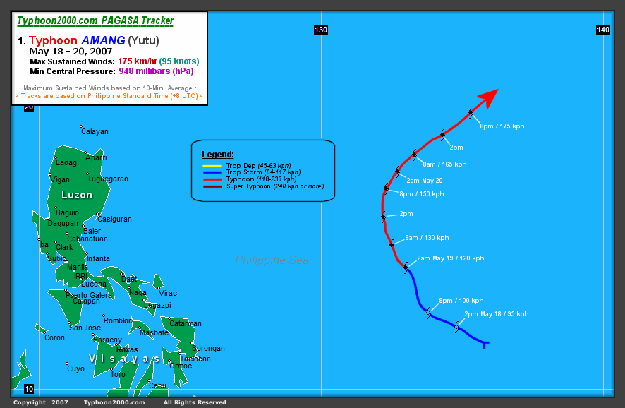
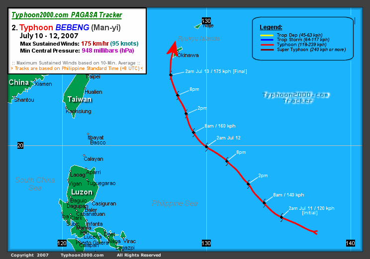
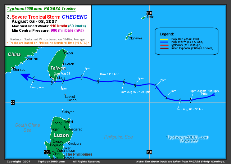
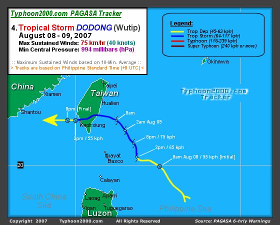
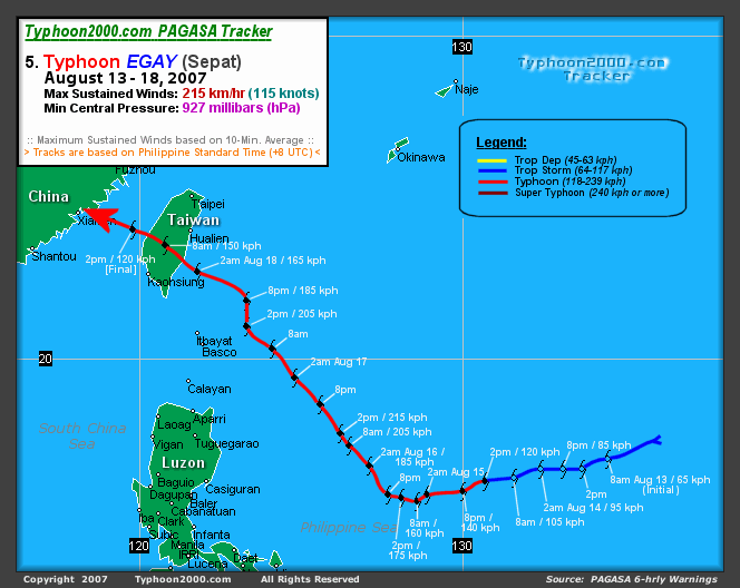
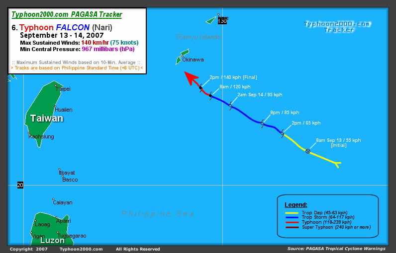
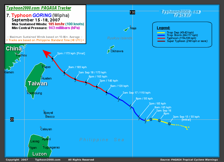
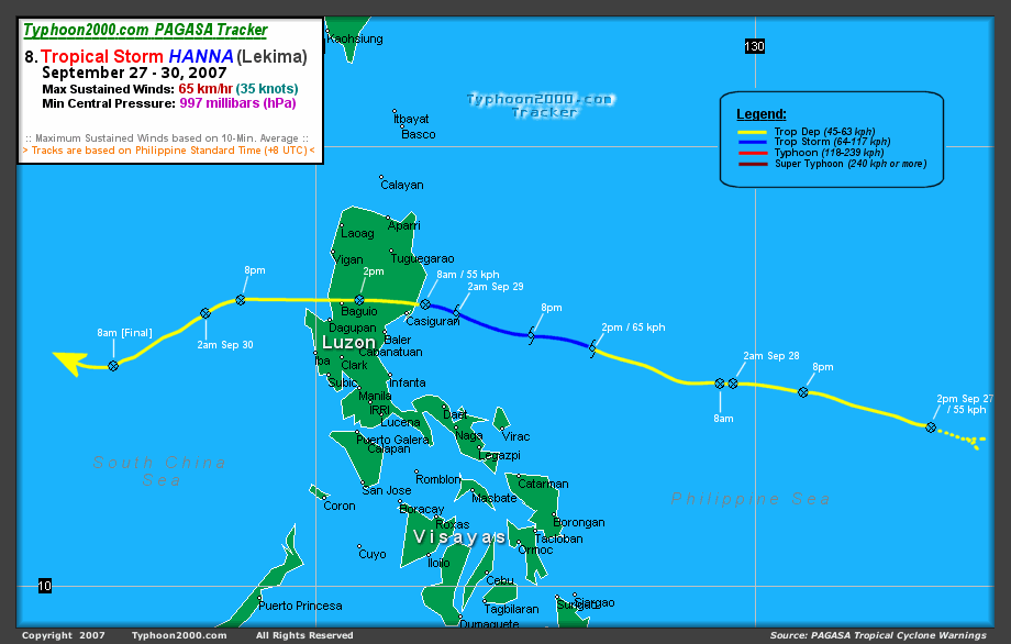
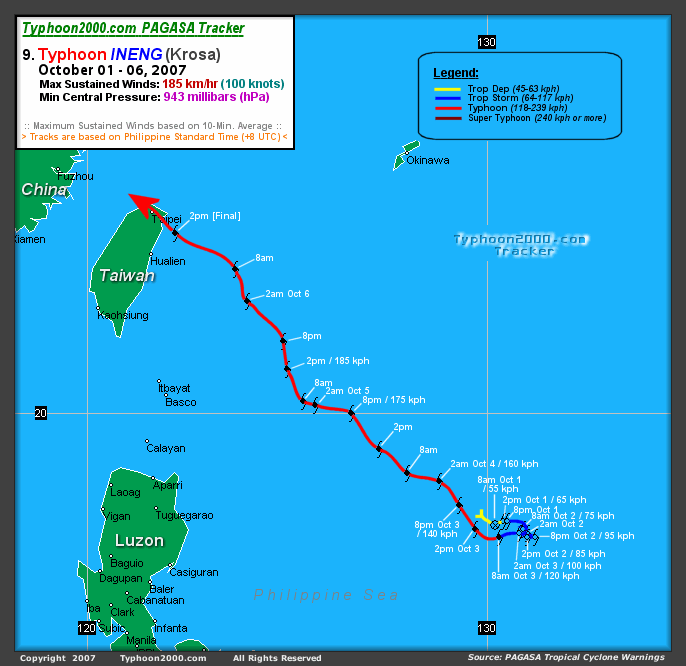
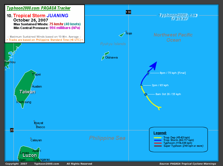
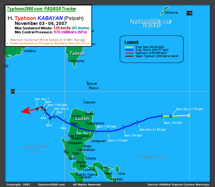
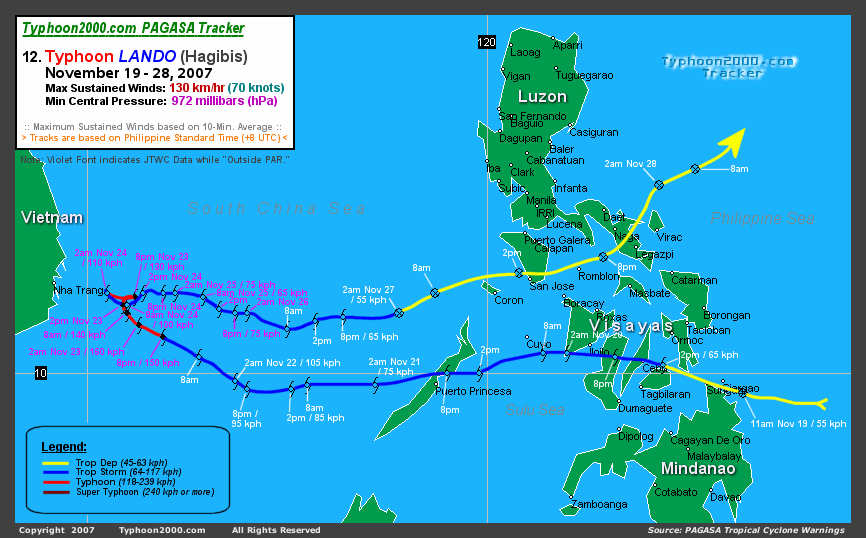
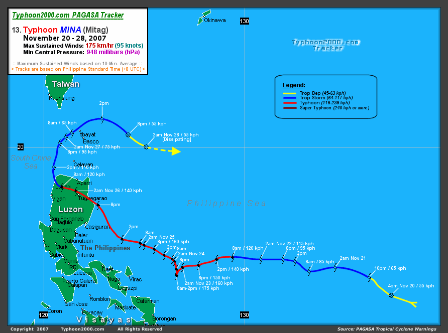
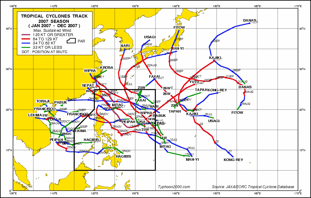
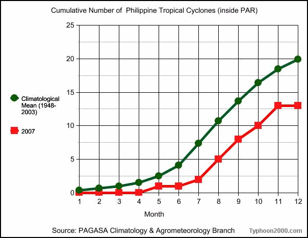
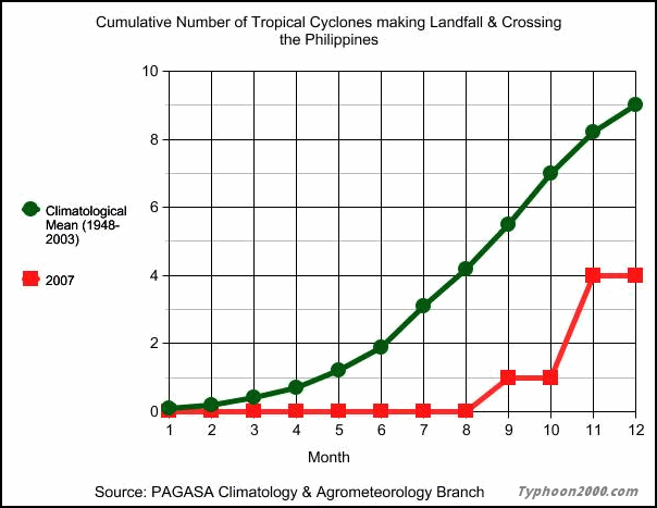
:: Here is the complete summary of Philippine Tropical Cyclones for 2007, occuring within the Philippine Area of Responsibility (PAR) and making landfall & crossing the Philippines. The Mean Average Data (1948-2003) are taken with permission from the PAGASA Weather Branch & the Climatology & Agrometeorology Branch. This summary includes number of tropical cyclones per month over the Philippine Sea or South China Sea, its category, and the mean climatological average of each month/year. At the near-bottom of this page are tracks/graphs showing all the tropical Cyclone tracks of 2007 and the cumulative number of Philippine Tropical Cyclones inside PAR & making landfall. Unauthorized use of this data in other websites is prohibited. If you want to proceed right-away to the 2007 Philippine Tropical Cyclones Gallery, click HERE. | ||||||||||||||||||||||||||||||||||||||||||||||||||||||||||||||||||||||||||||||||||||||||||||||||||||||||||||||||||||||||||||||||||||||||||||||||||||||||||
Home | Proceed to the 2007 Philippine Tropical Cyclones Gallery | Top Updated: 06.16.08 | ||||||||||||||||||||||||||||||||||||||||||||||||||||||||||||||||||||||||||||||||||||||||||||||||||||||||||||||||||||||||||||||||||||||||||||||||||||||||||
|
| About this Site | Disclaimer | Alternate Site | SiteMap | Contact | Advertise with Us | Add to Favorites | |
||||||||||||||||||||||||||||||||||||||||||||||||||||||||||||||||||||||||||||||||||||||||||||||||||||||||||||||||||||||||||||||||||||||||||||||||||||||||||
|
Copyright © 1997-2008 David Michael V. Padua Naga City, Philippines All Rights Reserved |
||||||||||||||||||||||||||||||||||||||||||||||||||||||||||||||||||||||||||||||||||||||||||||||||||||||||||||||||||||||||||||||||||||||||||||||||||||||||||